Face-to-Face Courses
Course Dates
- X429 Field Geology in the Rocky Mountains: Dates June 8 - July 21
- X498 Subdiscipline Concentrations: Dates June 27 - July 1
We have been teaching geoscience field courses at the IUGFS since 1949. During that 70+ year history, more than 7,000 students from over 300 universities have taken our courses.
Alumni routinely credit IUGFS as a key educational experience for their career success. The top IUGFS experiences cited for career success are:
2026 Course descriptions
EAS X429/498 – a 1-week, 1-credit face-to-face subdiscipline concentration course based out of the IUGFS facility in SW Montana. There are five subdisciplines to choose from. They are all taught simultaneously, so you can only take one X498 concentration course.
EAS X429 is our capstone course designed to prepare students to be successful in a geoscience career and/or geoscience graduate school program. This course focuses on the integration of geology, geochemistry and geophysics to solve 4-dimensional geoscience problems. X429 includes both a 1-week thesis style project and a deep-dive into a subdiscipline concentration of your choosing (see EAS X498 descriptions below).
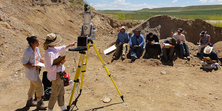
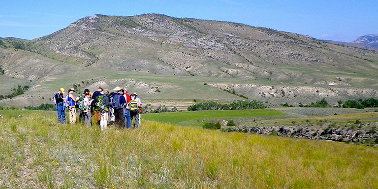
1. Detailed field instruction, typically with a 7:1 or better student-to-faculty ratio. The standard week includes detailed field instruction in one or more of the following:
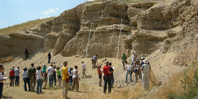
2. Week 6 is a major, report-style project – a 1-week geologic mapping, analysis, and interpretation project for a relatively large area with significant geologic diversity and complexity. Each student works quasi-independently to produce a report including geologic maps, geologic cross sections, relevant data and analyses, an interpretation of the geologic history, and an explanation about how it fits into the regional geologic context.
3. Field exams - Students work independently during three ~6-hour long field exams collecting basic observational data, constructing a geologic map and cross sections, and interpreting the geologic history of an area they have not previously visited. All materials are turned in prior to a debrief on the geology before leaving the field area. There are three or four field exams during the course.
4. A subdiscipline concentration – students choose the concentration that interests them the most and/or they want to develop more in-depth knowledge about. See X498 concentration descriptions.
Students' Backgrounds
In a typical year, EAS X429 students come from more than 25 different universities. In recognition that not all students have the same background when they start the course, the curriculum is designed to allow students to have more or less faculty interaction depending on their experience, learning needs, and confidence working in the field. EAS X429 grading is back-end weighted, with later projects counting more than earlier projects.
This course is as close as possible to a face-to-face course without actually going into the field. It utilizes: a) video lectures to replace the classroom and outcrop lectures; b) GPS located field video descriptions, photos, hand lens views, field notes, and field sketches of outcrops; c) Google Earth Pro for 3-D visualization of outcrop settings, tracing contacts away from the video field stations, etc.; d) topographic maps for geologic mapping; e) cross section construction, stereonet analysis, and other geologic analysis tools for interpretation.
This course is as academically rigorous as the IUGFS face-to-face field courses but does not pose the physical challenges and potential barriers. Most students who have taken this virtual course tell us they learned an immense amount about geologic mapping, geoscience interpretation, time management, and geoscience project management. However, most students also found the course very difficult because of the isolation of working online. As currently configured this course requires about 30-40 hours of structured learning plus up to 25 hours of “homework” per week for three consecutive weeks.
EAS X429/498 subdiscipline concentrations are an integral part of X429. We also offer these concentrations as 1-credit X498 courses for students who don’t take X429. We currently have five field-based subdiscipline concentration subjects. Each course is a 1-credit, 1-week course. All five courses are taught concurrently at IUGFS. Prerequisite for all X498 concentrations – students need to have taken at least three sophomore or higher undergraduate geoscience courses and have taken a field methods course or a geoscience field camp.
X429c/498c Igneous Intrusive and Extrusive Systems uses field relationships and geochemistry to unravel the geologic history and petrogenesis of a local geologic complex.
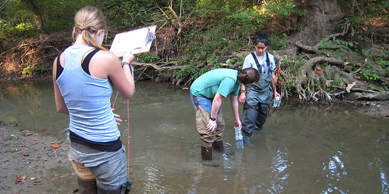
X429e/498e Environmental Geology and Surface Hydrology – studies the impacts of mining and other human activity on rock, water, and soil systems.
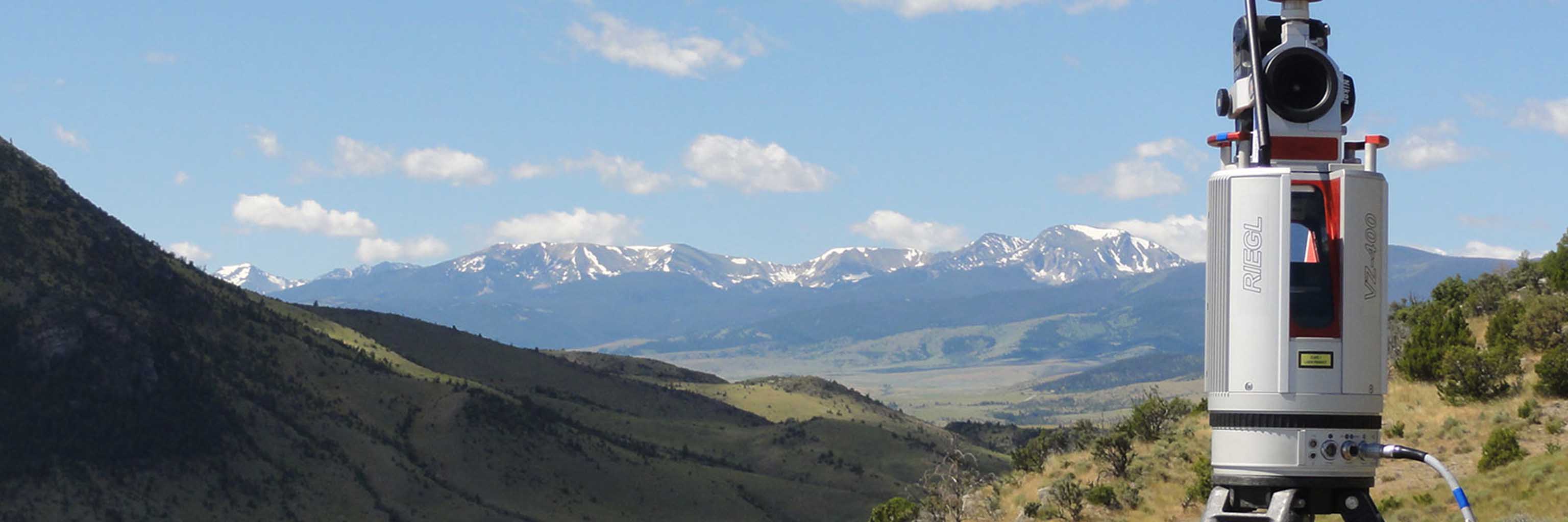
X429g/498g Digital Mapping Technologies uses quantitative methods to validate possible geometries and quantify geologic process on the landscape.
X429s/498s Sequence Stratigraphy, Depositional Facies, and Paleoclimate studies the relationships of depositional facies, sedimentary structures, fossil assemblages, and geochemistry to untangle depositional environment and paleoclimate interpretations.
X429t/498t Quantitative Structural Geology explores Laramide uplift structures and seeks to validate possible geometries associated with Cretaceous intrusions.
All of these courses are open to upper division undergraduates and graduate students.
Students with alternative backgrounds who do not have all of the prerequisites are encouraged to apply and will be considered on a case-by-case basis.
Basic admission criteria for EAS X429
Upon preliminary acceptance, we will schedule a 20-minute Zoom session for you to meet one of the X429 faculty. This meeting is for you to ask questions and to make sure you understand what the course and living at the Judson Mead Geologic Field Station will be like. This meeting is primarily so we can provide information to help you decide if an IUGFS course is the right fit for what you want to achieve and the experience you are looking for.
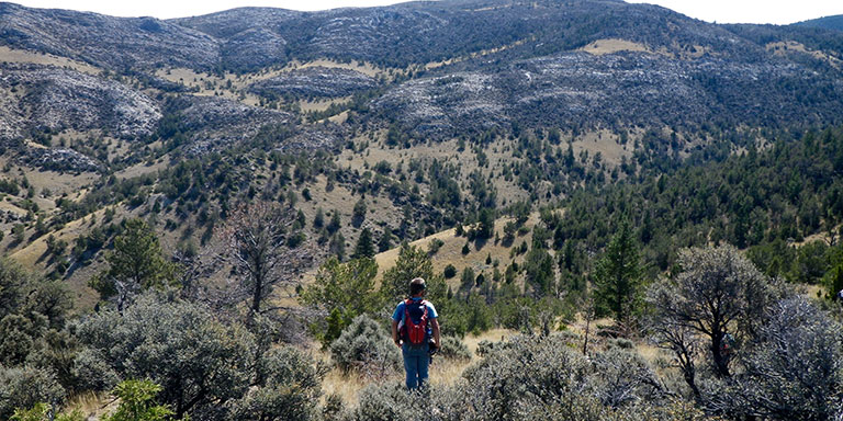
Working conditions in the field
EAS X429 and X498 are physically demanding. The typical week is six 10-hour field days. It is normal to hike 6 to 12 miles each day in terrain with more than 1,500’ of vertical relief. Average daily temperatures can range from less than 40°F at night to over 90°F during the day. The SW Montana climate is generally dry, but we can experience rain and even snow any day during the summer.
If you would not feel comfortable or safe in these circumstances, please consider the virtual session of E432 as an alternative for taking one of our physically demanding courses in the field.
 The College of Arts