Facilities & Instrumentation

Classroom and Geotechnology Center

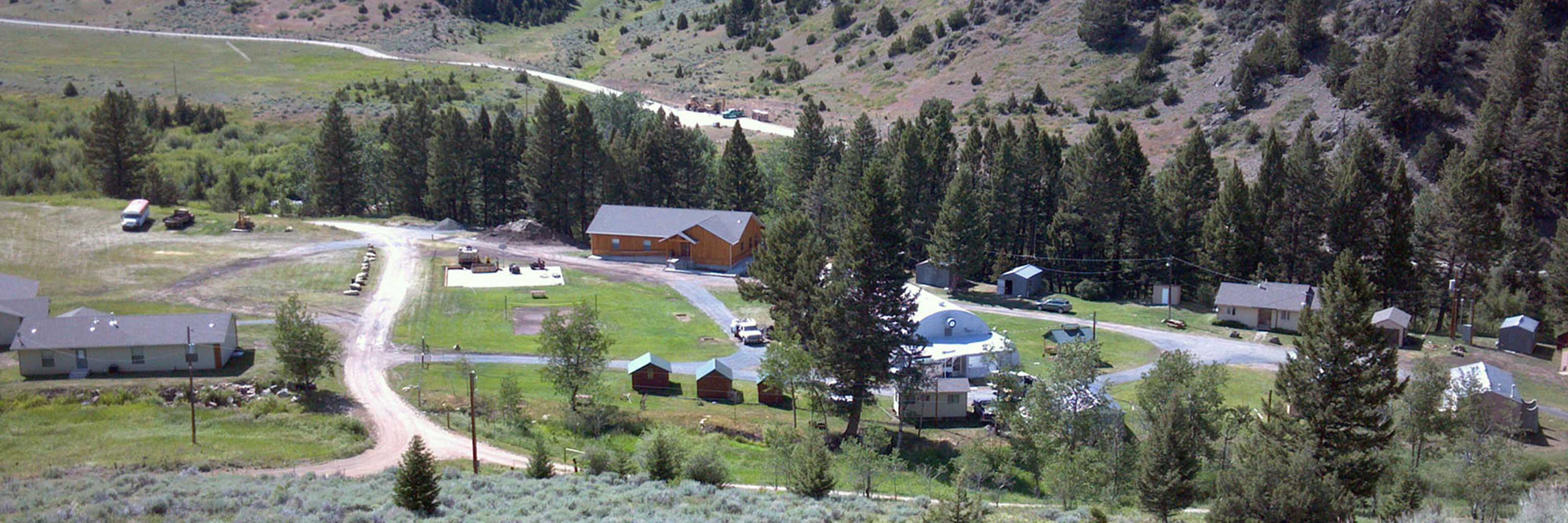
The new classroom and Geotechnology Center at the Judson Mead Geologic Field Station in Montana was dedicated in August of 2012. The two-story facility includes a state-of-the-art lecture hall, a computer center with 15 dual monitor desktop work stations, a lower level with laboratory space for field instrument storage and calibration, and a suite of sample preparation equipment and analytical instruments for geologic and hydrologic samples.

The new classroom building is located near the Charles F. Deiss Lodge, the heart of the Field Station. The lecture hall has a view up the South Boulder valley at the high peaks region of the Tobacco Root Mountain range.

Willow Creek Watershed

The Willow Creek Watershed in the eastern Tobacco Root Mountains is an outdoor laboratory for teaching, research, and applied investigations.

weather instrument measuring wind
Two people sitting next to large bin in a field
car battery with wires hooked up to power instrumentation
five students smiling with large bin instrument
battery inside metal bin powering instruments
wooden bridge over a flowing creek
watershed instrumentation next to flowing stream
students wading in flowing creek working with instrumentation
satellite map of the watershed

The setting is the centerpiece of the Department of Geological Sciences’ field environmental programs in Montana. It provides a framework for cooperation and benefit among students, university researchers, county, state and federal agencies, and local ranchers. The towns of Pony and Harrison are located within the watershed in Madison County, Montana. This drainage basin was chosen because of:

  • its proximity to the Field Station, and ready road access
  • manageable size (about 160 square miles)
  • the range of micro-environments with distinct ecosystems and land usage, ranging from alpine tundra to steppe prairies
  • the presence of a large surface reservoir (Harrison Lake)
  • diverse bedrock types, ranging from glacial deposits underlain by crystalline bedrock to thick unconsolidated sediments containing multiple aquifers

Daily stream report

Daily stream flow reports are only available during the “water year,” April 1 to October 1. The sensors are removed from the stream gauges during winter to prevent freezing.

Key elements of the demonstration watershed

Geological framework investigations are designed to understand the sedimentologic and hydrogeologic characteristics of the unconsolidated basin fill. These investigations consist of field mapping of surface exposures, analyses of drill cores and field determination of aquifer properties, such as hydraulic conductivity and storativity, and non-invasive geophysical surveys. Several IU graduate students have accomplished some of this work as part of their theses.

Hydrologic monitoring involves deployment of electronic instruments for continuous measurements of water levels in aquifers, stream stages, micrometeorological conditions (such as wind profiles, humidity and temperature gradients, solar and terrestrial radiation, etc.), and snowmelt. Sally Letsinger’s IU Ph.D. work consisted of installation of many such instruments, and developing the data-handling capabilites necessary to study their data. Descriptions of individual instrumented sites are accessible from the Willow Creek Demonstration Watershed map.

Computer modelling implements algorithms for simulating snowmelt in rugged terrain, streamflow routing, and groundwater flow in heterogeneous porous media.

Other studies have developed from teaching projects. Examples include stream assessments, the study of snow geochemistry to investigate possible relationships with orography or mountain geometry, and ranchers’ needs.

Watershed boundary map